Students forced to shelter as campus floods
Lipscomb University faced yet another set of evacuations Wednesday night, as several tornadoes wreaked havoc in the area.
Round after round of severe weather struck the state of Tennessee last night and at least four people are dead, while over two dozen are hospitalized with weather-related injuries. Fortunately, none of those were Lipscomb students, as one tornado came close, but eventually all swung clear around campus safely.
Four tornadoes touched down Wednesday night, one of them running up Granny White Pike for a while and coming close to campus. Lipscomb students were forced to evacuate twice into their respective safe places, the first time around 2 a.m. and the second a mere five minutes after being released back to their rooms, around 3 a.m. in the morning. Students had to remain in their shelters until around 5:30 a.m. in the morning.
“It was insane,” said Sewell RA Michael Sisaye. “Some of us RA’s didn’t even go to bed – we knew it was gonna happen. But after it was over, me and [two of the other RA’s] went to Waffle House. It was the best Waffle House I’ve had in my life.”
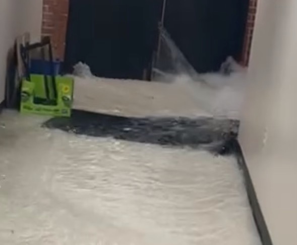
Four Lipscomb buildings flooded, along with several other exterior places around campus. Sewell Hall took the brunt of the flooding as waves of water broke through the exterior doors, filling the basement hallway ankle deep.
“I was just sitting on my couch cushion, watching the water creep closer and closer,” said Sewell resident Forrest Maners. “It was ridiculous.”
“It was fine until the water started coming in through the doors,” said Sewell resident Sam Rees. “It was really hot and stuffy in the basement though, all of us in one place.”
Bennett Campus Center also flooded, water streaming in to fill the basement — forcing the residents of Elam Hall sheltering in its basement to relocate to Shamblin Theater. “Fortunately we were only up in Shamblin for a little while,” said Elam resident Kennedy Scharfman. “It was a lot more cramped.”
Collins Auditorium also flooded, water filling the basement of the Burton Health and Sciences Center. Johnson Hall’s second floor flooded as driving rain blew in through the courtyard doors, but the basement did not, fortunately for the residents sheltering there. Elam Hall’s courtyard entirely filled with water.
Around the city, one person in Green Hills was struck by lightning while outside near a Hilton Hotel. Extreme flooding stalled out vehicles all down Interstate 65, and flooding caused at least one crash on Interstate 40. Several Nashville suburbs flooded, and standing water covered many streets and lawns in the area.
On Thursday, while maintenance crews ripped up baseboards in Bennett and brought in massive industrial fans to dry up some of the water, students prepared for more storms. Another large cell was supposed to hit Nashville Thursday evening, and the storm threatened hail, flooding and more tornadoes. The storm also threatened Singarama, and student performers waited to see if the tornado warning would clear in time for the show to go on.
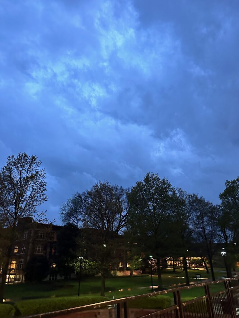
The promised storm only briefly hit campus, rain crashing down with soak-to-the-skin intensity and turning the nighttime sky blue and gray for a mere ten minutes. Just as quickly as it had begun, it stopped, the rain passing to a mere sprinkle. Singarama went on, and students were able to sleep through the night uninterrupted by tornado sirens and evacuations to safe places.
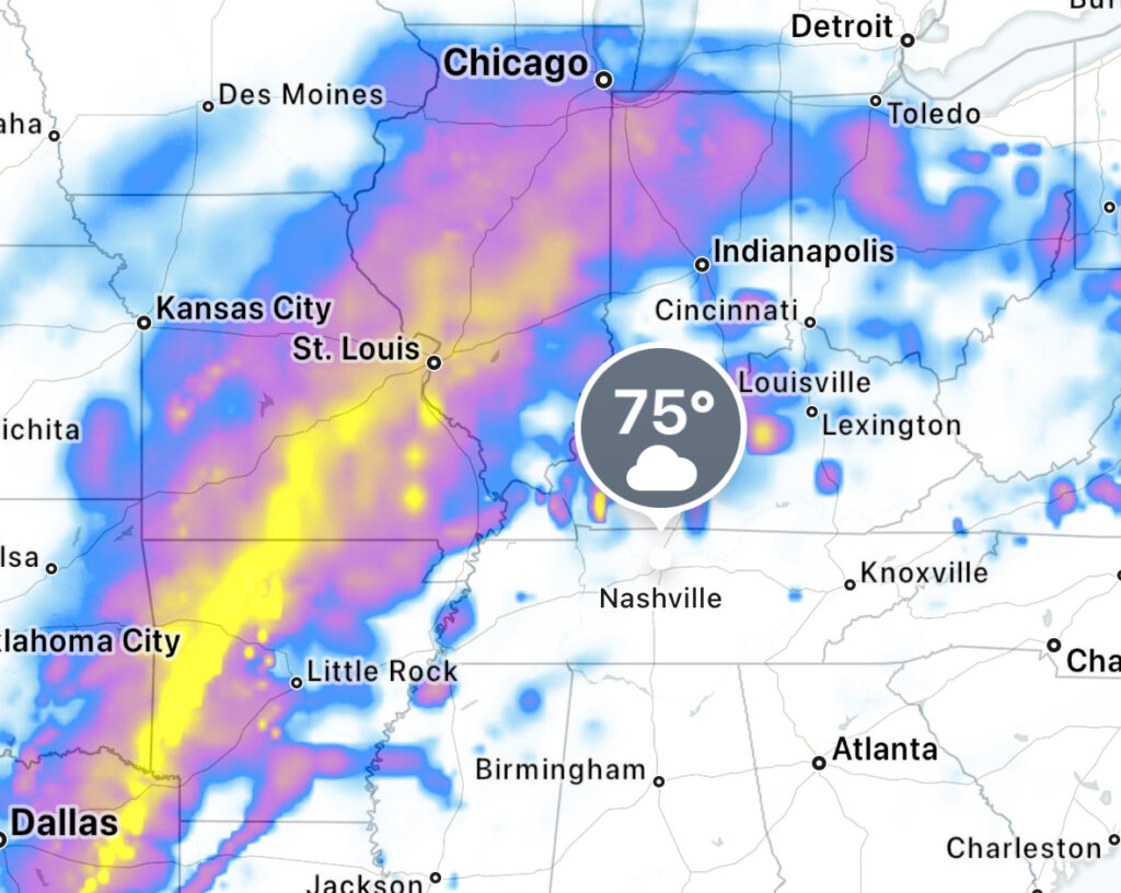
Nashville is expected to get more rain over the weekend, with the worst of the storms forecasted for Sunday evening. Middle Tennessee is under a flood watch until Sunday, and the watch extends to Nashville areas. Several rounds of thunderstorms and rain showers are forecast through Sunday, and flooding is a concern because the soil is already heavily saturated.
At the moment the weather system is moving along north of the area, but thunderstorms are forecasted to swing through the area around 5 p.m. this evening. Saturday has rain forecasted for most of the day, storms starting with a 15% chance around 7 a.m. and continuing to rise to a 60% chance at 11 p.m. that night. The storms are currently forecasted to continue all throughout the night and throughout the duration of the day Sunday, eventually tapering off to hover around a 10% chance at 10 p.m. and stay that way the rest of the night.
The threat of tornadoes is due to Tennessee’s currently fluctuating temperatures, in the midst of such storms. As the weather swings back and forth between warm and chillier, it creates the perfect atmosphere for tornadoes to grow in. The changing temperatures causes warm and cool air to shift places and mix, which builds a tornado breeding ground. The most threatening day for tornadoes is Sunday – starting in the very early morning – as the temperature is forecasted to drop from highs in the eighties and lows in the sixties, to highs in the sixties and lows in the forties.
This weekend, keep an eye on your local weather station’s forecasts and keep your phone on to receive any tornado or severe weather alerts. Know where you’ll shelter, and if possible, put your car in a garage or under some form of cover to protect it from the possibility of hail. Take the necessary precautions and stay safe this weekend.
Feature image courtesy of Sam Rees.


